
Irving ZIP Code Directory Coverage
The Texas geographic-code reference lists eleven Irving ZIP entries: 75014, 75015, 75016, 75017, 75038, 75039, 75060, 75061, 75062, 75063, and 75084. That list is a starting point, not a city-limit map or a promise that each number is a current standard street-delivery ZIP. The research confirmed named postal points for four ZIPs and did not independently reconcile current delivery status for several others. Use a full address in USPS tools before drawing a postal conclusion.
| ZIP Code | Areas Covered | Post Office | Notes |
|---|---|---|---|
| 75014 | Listed as an Irving entry in the state reference | Not identified | Current delivery status was not reconciled |
| 75015 | Listed as an Irving entry in the state reference | Not identified | Current delivery status was not reconciled |
| 75016 | Listed as an Irving entry in the state reference | Not identified | Current delivery status was not reconciled |
| 75017 | Listed as an Irving entry in the state reference | Not identified | Current delivery status was not reconciled |
| 75038 | Irving entry; city notes local diversity context | Central Irving | Verify the exact address and ZIP+4 |
| 75039 | Irving entry in the state reference | Las Colinas | Postal point is not a boundary line |
| 75060 | Irving entry; older material groups a delivery office here | Not confirmed as current | Older postal material is archival only |
| 75061 | Irving entry in the state reference | Main Office | Use USPS for present delivery details |
| 75062 | Irving entry in the state reference | Historic Carl Range association | The station ended service in 2010 |
| 75063 | Irving entry in the state reference | Valley Ranch | Verify the full address and ZIP+4 |
| 75084 | Listed as an Irving entry in the state reference | Not identified | Current delivery status was not reconciled |
The Texas geographic reference supports the entry list. It does not supply a current street-by-street boundary file, neighborhood coverage map, or a conclusion about municipal jurisdiction.
The named points help with a practical address check, but the source set does not assign every Irving street or neighborhood to a definitive ZIP area. That is why several rows say that current delivery status was not reconciled. USPS address lookup is the live confirmation channel. The historic references for 75060 and 75062 are included to prevent a common error, using an old postal-office change as though it were a present boundary change.
Note: Treat the state list as a directory of geographic entries, then confirm a specific delivery address through USPS.
Search an Irving ZIP Code
A ZIP code can narrow an address check, but the inspected sources do not provide a verified universal ZIP-wide resident search. Use postal data to normalize a specific address, then shift to the official record that is keyed to that address or parcel. This avoids treating a mailing label as evidence of an occupant. The USPS address and ZIP starting point is the appropriate first stop for a current delivery check.
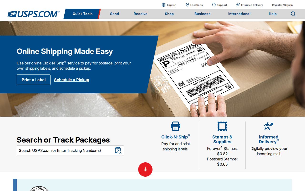
The postal starting page leads to current address-standardization tools, which should be used before a parcel or city-map search.
- Enter the complete street address, city, and state in the USPS address lookup, then record the returned ZIP and ZIP+4 without assuming a city boundary.
- Use the standardized address in DCAD's address or map search and save the account number and legal description if a property record is returned.
- Compare the parcel with Irving's planning map or subdivision information when the question is about city jurisdiction, zoning, or a recorded plat.
- Use the Dallas County deed index only when the address, parcel, subdivision, or recorded party provides a relevant record trail.
Once the ZIP is narrowed to a street address, the address-keyed steps belong in the Irving street directory, where the parcel, map, deed, and plat paths are treated in more detail.
Dallas County's voter-status lookup is another distinct system, not a ZIP-wide directory. Its live fields could not be confirmed because the route returned HTTP 403 during research. The state and county channels remain the right places to ask about permitted voter information, while protected voter addresses and identifiers remain outside a general ZIP search.
Irving ZIP Code Lookup Fields
USPS accepts either a street address with city and state or a ZIP lookup input for the practical delivery check described in the research. Its address result can supply ZIP+4 for a full address. Do not infer undisclosed ZIP+4 coverage from a general ZIP entry. The research did not preserve every live form label, so this table stays with the documented input types rather than inventing controls.
| Street address | Use the full street address to obtain the current postal format and ZIP result. |
|---|---|
| City and state | Pair these with the street address when checking an Irving delivery address. |
| ZIP input | Use the ZIP lookup route when the postal code is the starting information. |
| ZIP+4 result | Use it to validate the specific address, not as a city-limit or parcel identifier. |
For the live address form, open the USPS ZIP Code Lookup by Address.
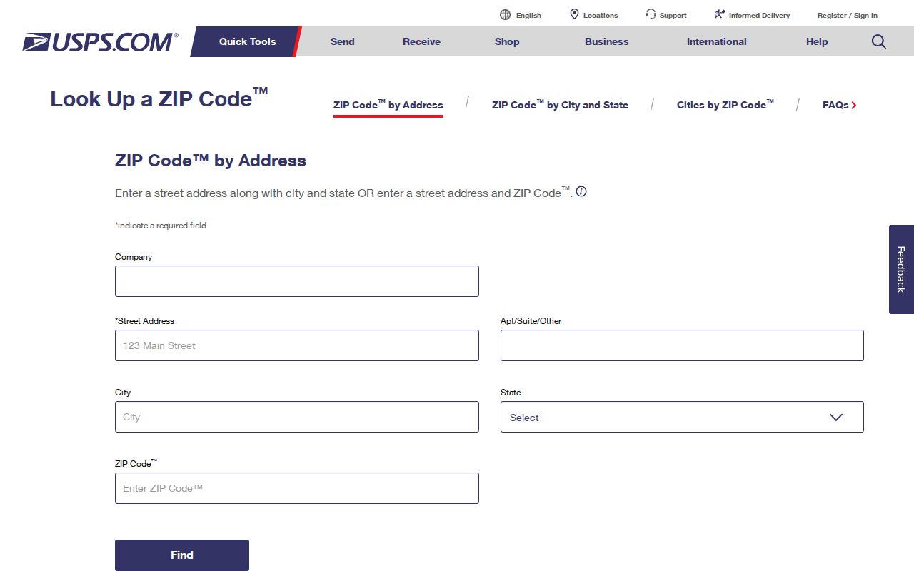
The address-based lookup is the source for a current ZIP and ZIP+4 check, while the state reference remains a broader geographic list.
DCAD uses a different form after the postal check. Its By Address route requires an address number and street name, allows direction, building, suite, city, optional number range, and account type, and does not take a street type as a separate entry. A ZIP is useful for checking the address first, but it is not the documented DCAD address-search field.
Irving ZIP Code Postal Points
Named postal points explain why a mailing label may use a local place name that differs from a neighborhood or city planning label. The research identifies the Main Office at 2701 W Irving Boulevard, 75061-9997; Central Irving at 2300 Story Road W, 75038-9998; Valley Ranch at 8501 N MacArthur Boulevard, 75063-9998; and Las Colinas at 3900 Teleport Boulevard, 75039-9998. These are useful validation points, not evidence that every address with the ZIP lies within one local district.
Check the Irving Main Post Office location page for the latest postal services and hours.
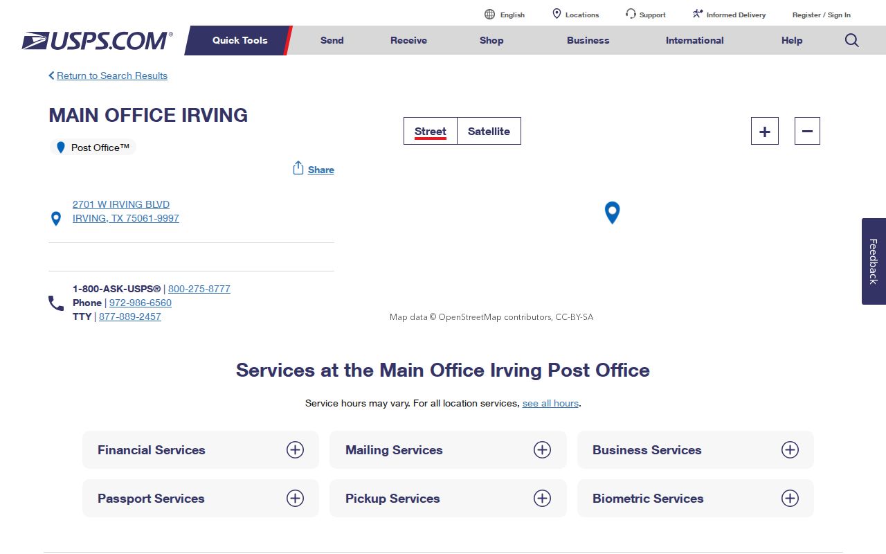
The Main Office listing provides a concrete postal point for 75061, but an address lookup remains necessary for a particular delivery address.
Central Irving, Valley Ranch, and Las Colinas each have their own USPS location page. Their names are practical postal references, not a substitute for a parcel map, a survey, or the City of Irving boundary data.
Note: A named post office supports a postal check but does not establish a neighborhood edge or city jurisdiction.
Irving ZIP Code Boundaries
ZIP code boundaries are delivery geography, while Irving city limits are municipal geography. Postal city names can extend beyond a city boundary, and a city address can require a different postal label. Pair the full address with USPS, the DCAD parcel, and the relevant city map before making a jurisdiction statement. The City of Irving resident information notes that 75038 is among the nation's most diverse ZIP codes, but that context does not identify any person or define the ZIP boundary.
- ZIP and ZIP+4
- A ZIP identifies a postal delivery area. ZIP+4 adds delivery detail for a specific address or delivery segment.
- PO-box ZIP
- A ZIP used for post-office boxes. Its presence does not show a street-delivery area.
- Unique ZIP
- A ZIP associated with a single organization or delivery arrangement and requiring USPS confirmation.
- Carrier route
- A postal delivery grouping. It is not a municipal boundary or proof of residence.
Boundary check. Use a full address, its USPS result, the parcel record, and city mapping together before assigning an Irving jurisdiction.
Irving ZIP Code Parcel Checks
DCAD is the useful handoff after postal normalization. Its map can search an account, property address, owner name, doing-business-as name, subdivision or condominium, survey abstract, map grid, Dallas block, or neighborhood. The map can also identify parcels and show layers, but its help warns that boundaries are approximate and are not a certified appraisal roll or legal survey.
Irving Planning supplies a separate address and point-query route for zoning, tax, and subdivision information. A known subdivision can lead to a plat through Planning or the County Clerk. When a ZIP code address is near a municipal edge, compare these official layers rather than using the postal label alone. The DCAD map and Irving Planning guidance provide those distinct checks.
Note: A parcel account and legal description are more durable research notes than a ZIP label copied without its full address.
Irving ZIP Code History
Postal history is useful only when it is labeled as history. The research notes that Carl Range Station, associated with 75062, was discontinued in 2010, and that Downtown Classified Station associated with 75060 ended earlier. Those changes do not prove a ZIP boundary change. The archived USPS bulletin is historical context, not current address evidence.
For dates and discontinued offices, use the USPS post-office-by-ZIP historical lookup, then return to the current address tool for deliverability.
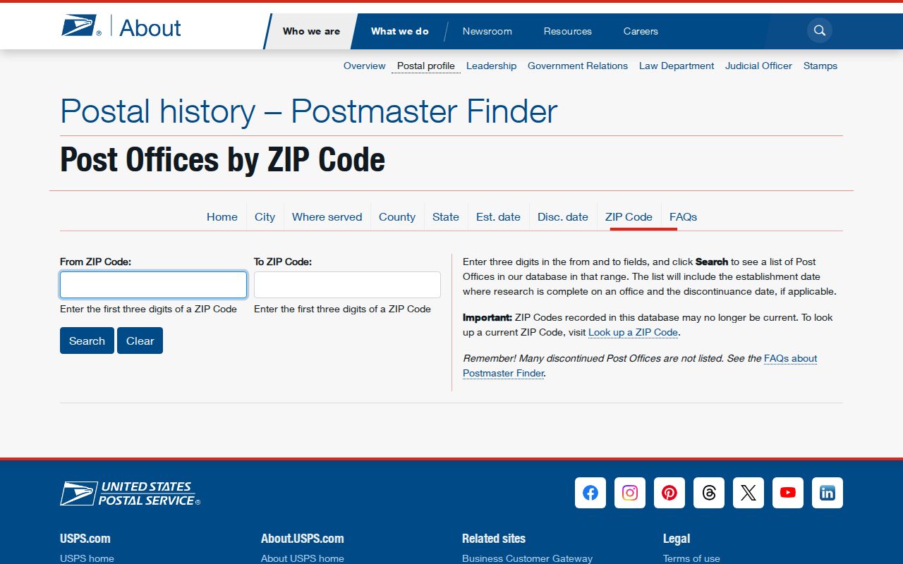
The historical interface uses ZIP ranges and office dates, and USPS warns that its historic list may not remain current.
Note: Verify current delivery with USPS address lookup even when an older office date appears to match an Irving ZIP.
Irving ZIP Code Directory Notes
The useful lesson from the Irving ZIP code directory is modest: use each system for the question it can answer. USPS verifies a current mailing format. DCAD ties an address to an appraisal account and parcel context. City Planning can add zoning or subdivision context. The Dallas County Clerk's deed portal can connect a known parcel, subdivision, recorded party, or document term to a recorded instrument. None of those sources alone creates a reliable list of people within a postal area.
Keep a source note with the full address, search date, ZIP or ZIP+4 result, parcel account, and the map or document route used. The state list did not reconcile live USPS boundaries, current ZIP+4 coverage, or the delivery status of 75014, 75015, 75016, 75017, and 75084. Mark those as items to confirm, not as missing or invalid ZIPs.